Crews push forward
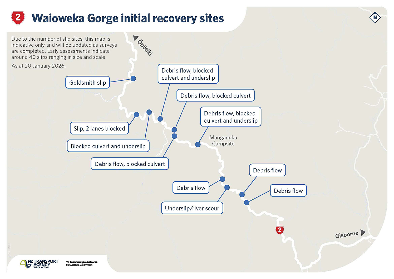
SLIP SITES: NZTA has released a map of initial recovery sites which will be updated as surveys are completed. While they are not all shown here, early assessments indicate there are around 40 slips ranging in size and scale. Graphic supplied
Diane McCarthy
While good progress has been made from both ends of Waioeka Gorge to clear slips, New Zealand Transport Agency Waka Kotahi had to withdraw crews yesterday afternoon due to a red heavy rain warning.
MetService was predicting 180 to 240mm of rain for all parts of the Bay of Plenty between 1pm Wednesday and 9am Thursday with peak rates of 25 to 40mm per hour.
Even higher levels were being predicted for Gisborne district with 250 to 350mm of rain expected.
With the network is already in a fragile state, NZTA was closely monitoring the weather system as there was a risk that more loose material could come down.
“Keeping our crew safe is paramount, said SH2 Waioeka Gorge response and recovery controller Rob Service.
“This will allow crews to rest and return safely on Friday to continue recovery efforts over the long weekend.”
While it was clear damage was extensive, with early assessments indicating around 40 slips ranging in size and scale, the full condition of the road and underlying structures remained uncertain until debris could be safely cleared.
“Our focus remains on restoring at least one lane of access. We do not yet know what this will look like or when it will be possible, but we will share updates as soon as we can.”
By Wednesday morning, crews had fully cleared two slips from the Gisborne side of the gorge and work continued on drainage and clearing blocked culverts.
NZTA teams were also supporting vehicle recovery where safe access allowed.
From the Ōpōtiki end of the gorge, eight trucks and three digger crews were on track to removing 60 large truck loads of material from what is being called the Goldsmith slip – the first slip from the Ōpōtiki side and potentially largest at about 110 metres high and up to 60 metres wide.
Two additional crews were focusing on drainage and opening culverts to reduce the risk of further issues.
There had been a significant increase in traffic on SH2 south of Gisborne, as people used this detour and travellers were being asked to delay travel where possible or allow significant extra time if using SH35 around the East Cape or SH5 through Taupō.
SH35 in particular was not a reliable detour route in severe weather.
NZTA acknowledged SH2 was the primary connection between Gisborne and the Bay of Plenty, that there was no short or convenient detour, and the disruption was significant for communities and freight movement.
“We appreciate everyone’s patience and understanding during this significant disruption.”
New Zealand Post was also heeding the red heavy rain warning cancelling all rural deliveries during the severe weather event.