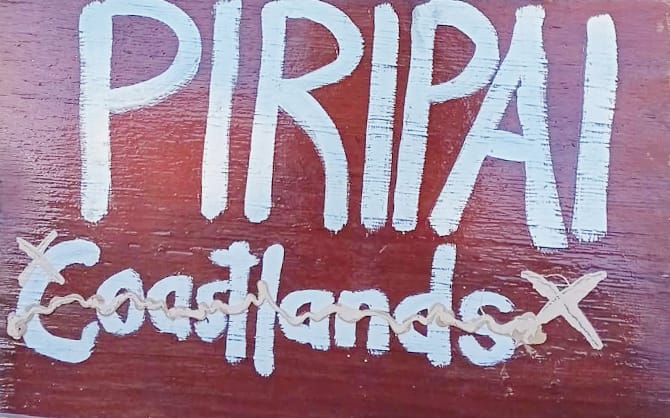
'We are not Coastlands'
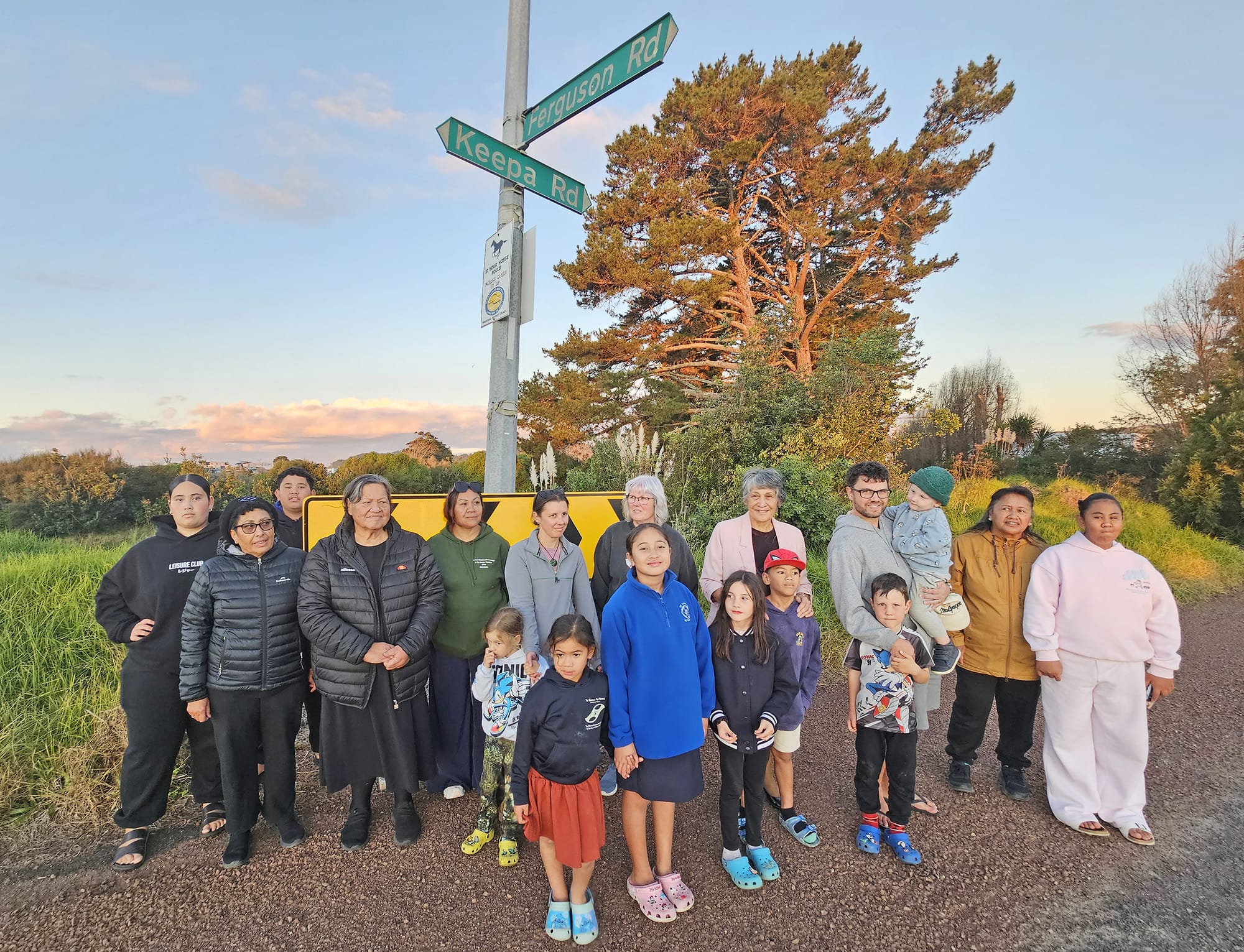
Not our name: Members of Ngāti Hokopū and Ngai Taiwhakaea living in Piripai and Pāroa are fed up with their whenua being referred to as “Coastlands”. Photo Diane McCarthy E5984-9
Diane McCarthy
People living in areas of Whakatāne district they know as Piripai, Pāroa and Poroporo have had enough of being grouped under the generic name of Coastlands.
Piripai tangata whenua Pearly Sullivan, Margie Biddle and Billy Keepa say having their whenua renamed Coastlands erodes their people’s identity and connection with the land as well as the land’s history.
As well as being incorrect, it is a name that touches on old wounds among some members of hapū, Ngāti Hokopū and Ngāi Taiwhakaea.
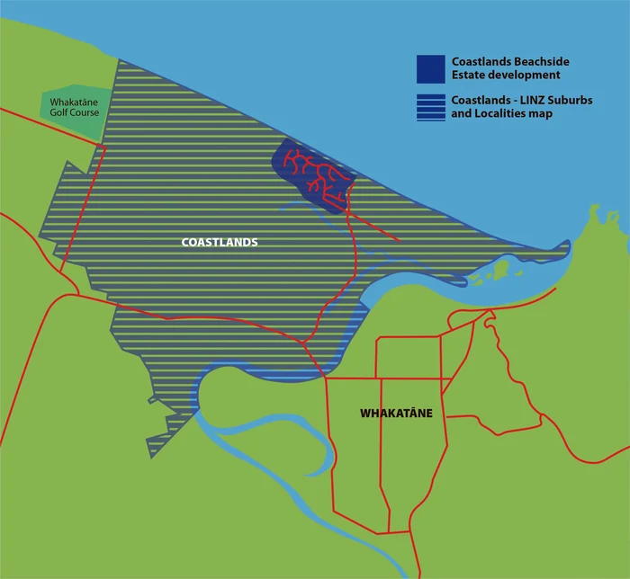
Coastlands Beachside Estate is a residential subdivision developed at Piripai, started in the 1970s by Lysaght Developments. It covers a 1.36 square kilometre area at the end of Keepa Road.
Sullivan, who has lived on Keepa Road all her life, says she remembers watching the trucks shifting tonnes of sand from the development past her house during the early 1970s and taking topsoil from the southern end of Keepa Road to create the sections there.
With its proximity to Ōpihi Whanaungakore urupa, some considered that land to have been wahi tapū.
“We were so humble, we just allowed them to do it. There’s another name some people use for that development. They call it Ghostlands,” she said.
For these three women, Piripai is the name of the area. Their marae, Te Hokowhitu a Tū, is at Piripai, a Māori translation of the Biblical Macedonian town of Philippi, where the Apostle Paul formed the first Christian church in Europe.
It is where Ngāti Hokopū crossed the river from Whakatāne to grow their kai, and where young men gathered for karakia before going off to fight in two world wars.
It is land confiscated in the Raupatu of the 1890s, with some returned early last century.
However, when residents at Piripai, or their marae or kura receive any communication that uses the NZ Post Addresses and Postcodes database to form addresses, the suburb given is “Coastlands”.
This includes any mail from central or local government organisations or businesses, such as rates invoices, electoral forms, or electricity bills.
They have even heard Keepa Road, a name that is part of their whakapapa, referred to as “Coastland’s Road”.
“It’s terrible. How did this happen? That’s what I’d like to know,” Keepa said.
The same issue is noted in parts of Pāroa and Poroporo, with Coastlands used for a large area west of Whakatāne township, as far as the golf club and south as far as Fortune’s Road. This is despite Coastlands not being an official name for any of these areas, according to the New Zealand Geographic Board.
NZ Post general manager Matt Geor told Local Democracy Reporting NZ Post acknowledged the significance of place names to mana whenua and local communities and would deliver mail addressed to Piripai.
“NZ Post is required to use official place names, as set by local councils, LINZ and NZGB. Having said that, we do recognise some alternative place names.”
Four suburb names Geor said were recognised by NZ Post and could be used interchangeably with Coastlands were Awakeri, Piripai, Poroporo and Thornton.
“This ensures we can deliver mail to the correct address, even if a sender has not used the official name.”
Despite this, NZ Post’s Address and Postcode Finder on its website changes the suburb name to Coastlands whenever an address is typed in.
“As Coastlands is the official place name in this area, our post code finder defaults to this as the alternate to RD1. However, if a sender addressed an item to a recipient in ‘Piripai, Whakātane, 3191’ our driver would still be able to deliver it to the correct address.
“To have Piripai recognised as the official place name, we recommend approaching the New Zealand Geographic Board and Whakatāne District Council.”
A LINZ spokesperson said anyone could make a proposal to the NZGB to have a place name made official. However, this would not necessarily change how addresses were structured.
New Zealand’s addressing system is not based on the NZGB’s Gazetteer of place names, which lists Coastlands as a “recorded but unofficial name” alongside Piripai, Pāroa and Poroporo, but on a second dataset, administered by LINZ called the NZ Suburbs and Localities dataset. This dataset underpins not only postal addressing but also the electoral roll and emergency services location data.
The database was created by Fire and Emergency New Zealand in 2005 to assist emergency first responders to quickly locate an emergency call.
It was transferred to LINZ in June 2023. Anyone may request a change to suburb or locality name or boundary by contacting the relevant local authority or directly through emailing [email protected].
Local councils, Fire and Emergency New Zealand and NZ Post can make the request through a restricted online portal.
A review panel with representatives from relevant local authorities (if they wish), NZGB, Emergency Services, Māori-Crown Relations, NZ Posts, Stats NZ and LINZ, meets three times a year to decide whether to accept the request.
Whakatāne District Council has been approached for comment.

Thousands of Māori place names unofficial
The Gazetteer of New Zealand records 910 unofficial place names in the Whakatāne district, including Coastlands, Piripai and Pāroa.
This is the second highest in New Zealand after the Far North district, which has 1682, and there are several thousand throughout the country, most of them Māori names.
Ngā Pou Taunaha o Aotearoa – New Zealand Geographic Board, the Government entity controlling place names, is progressing a fast track programme to make some of these names official.
A spokesperson for Toitū Te Whenua Land Information New Zealand, which provides administrative services to the board, told Local Democracy Reporting this programme was focused initially on Māori place names that were already widely used, where there were no alternative names, and the board considered there was likely to be no public objection.
The board worked with local authorities, mana whenua and official te reo Māori translators to ensure names were correct before making them official.
“The next batch scheduled is the Far North District ... Whakatāne district has not yet been scheduled,” the spokesperson said.
“It is important to note that [the board] prioritises its work on names proposed through Treaty settlements and standard process proposals submitted by the public. Other work including this fast-track programme is progressed as resourcing allows.”
Coastlands, which is not an official name, would not be considered for fast track approval, as it did not meet the criteria.
The board’s Gazetteer is the official record of place names, covering natural and man-made features such as rivers, mountains, suburbs and towns, and is separate from LINZ’ Suburbs and Localities dataset, which defines boundaries for urban suburbs and rural localities for location and addressing purposes.
Both databases could be used by digital platforms such as Google Maps, and both have processes that can be accessed through the LINZ website linz.govt.nz for any member of the public or organisation to make proposals for name changes.