Clay enthusiasts gather
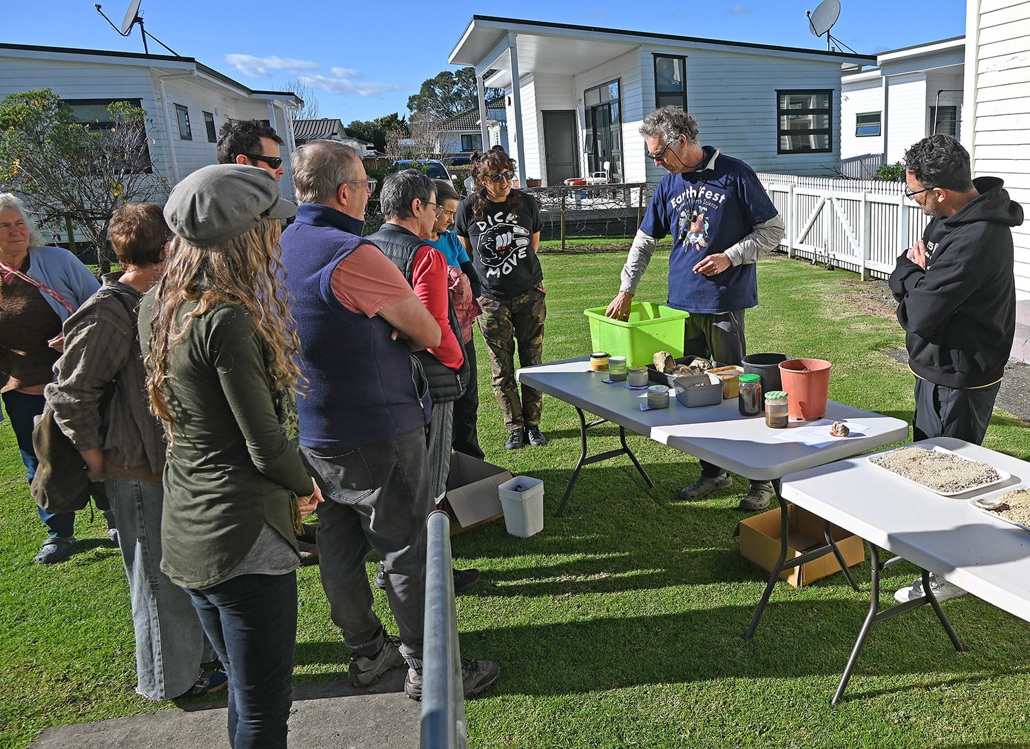
science and geology: Ilmars Gravis leads a Wild Clay workshop. Photo supplied
Paul Charman
A “Wild Clay” workshop at St John’s Lounge provided an opportunity for locals to find out more about the ground beneath their feet.
The gathering on Saturday looked beyond Ōpōtiki’s volcanic ash and pumice soils to aeons of geological history that underlie our district’s geography.
“Eastern Bay landforms are dynamic,” said science educator Ilmars Gravis. “They consist of ancient sedimentary basement rocks, products of explosive and catastrophic volcanic activity and dynamic coastal environments – and they’re actively on the move.
“All these materials and processes have helped to shape a variety of clays we find in the Eastern Bay”.
Gravis went on to extoll the primary characteristics of a clay, minerals in the form of one of the smallest earth particles known, each one potentially having 1000 times the surface area of a grain of sand.
“Clay’s chemistry and structure make it a useful substance throughout human history; we’ve made practical ceramics from clay for thousands of years. Its particles boast an electric charge which enables them to uniquely react with water, and obviously it can be transformed to a rock-like material through firing.
“Glazes made of natural earth materials can be used to create an infinite list of colours and effects, depending on the constituent metals and minerals. Traces of pottery (shards) at archaeological sites have given us insight into the history of the cradle of civilisation in the Middle East, while Lapita pottery shards have been used to track the migration of Pacific peoples.
“The fact that we can work clay into objects that can last thousands of years is a marvel. Ceramicists are effectively doing in a few hours or days what nature might take thousands of years to accomplish.
“Though humans alter the chemistry of clay by adding heat, nature has an additional trick. It can change clay by squeezing it under thousands of tonnes of rock and strata, forming many kinds of elements and rocks through heat and unimaginable pressures.”
More than a dozen people attended the workshop at St John’s, with some travelling from Gisborne and Whakatāne. As well as practicing ceramicists, others were curious locals interested in the land around them. One person was familiar with the properties of clay from building an earth house. Another described herself as a “recovering geologist”.
The seminar gave an overview of the earth beneath our feet, with images depicting geographic formations in our district and beyond. Introducing resources for building a deeper understanding of local and regional geology, Gravis described the sedimentary sandstones and mudstones (greywacke and argillite) forming familiar landforms such as the Raukumara ranges, Te Urewera ranges, and the Whakatāne Heads.
These ancient rocks were formed from underwater landslide deposits settling on an ancient seafloor off the coast of the Gondwana Supercontinent about 200 million years ago. Our landscape west of Ōpōtiki, was being driven by the spreading Taupō volcanic zone, a volcanic rift measured to be spreading around 10mm a year in the Bay of Plenty.
“Because of the heavy volcanic activity inland and steep mountains to the east, the coast has been heavily reshaped by moving water and sediment. Coastal cliffs around Ōpōtiki and Kutarere have exposed layers of marine sediments, river gravels and coarse volcanic ash.
“Longshore currents carrying massive sediment loads have resulted in barrier spits enclosing the shallow harbours and lagoons of Ōhiwa.
“A combination of steep terrain, active tectonics, and weak rock types makes the Eastern Bay of Plenty highly prone to environmental shifts. Landslides are a common hazard through areas like the Waioeka Gorge.
“While greywacke can be stable, it becomes loose when fractured. The tertiary mudstones found overlapping the east coast are considered some of the most highly erodible rocks in the world when cleared of native bush.
“Earthquakes and tectonics keep the landscape continuously shifting. For instance, during the 1987 Edgecumbe Earthquake, the physical distance between Matatā and Whakatāne widened by 1.2 metres in a matter of seconds. “So, make no mistake – ours is a hugely active part of New Zealand.”
After hearing about local volcanology, sedimentation, geothermal activity and erosion, participants moved outside to examine samples of local clays and sands.
Gravis said he would like to hear from anyone who could not make it to Saturday’s workshop, to gauge interest in a follow-up.
He also wanted to assess interest in guided field trips supported by classroom-style learning. “I’ve been very heartened by the response to this, and I am looking forward to holding a workshop in Whakatāne, given the interest shown from a very active potters group.
“This style of community education and sharing my love and passion for earth sciences is something I am very interested in developing further, working with educators, community leaders, and curious locals of all ages.”
He can be contacted at [email protected]